Applications
Discover more about the drone solutions we have to offer
Because we know that every customer is unique, we at AirSig3D always do our best to customize our solutions to fit the needs of our clients as closely as possible.
While our different drones allow us to work efficiently everywhere - from archeology to blasting site supervision - we do not limit our services to mere drone flying: we can also perform high precision post-flight photogrammetric treatment, and supply any type of GIS software.
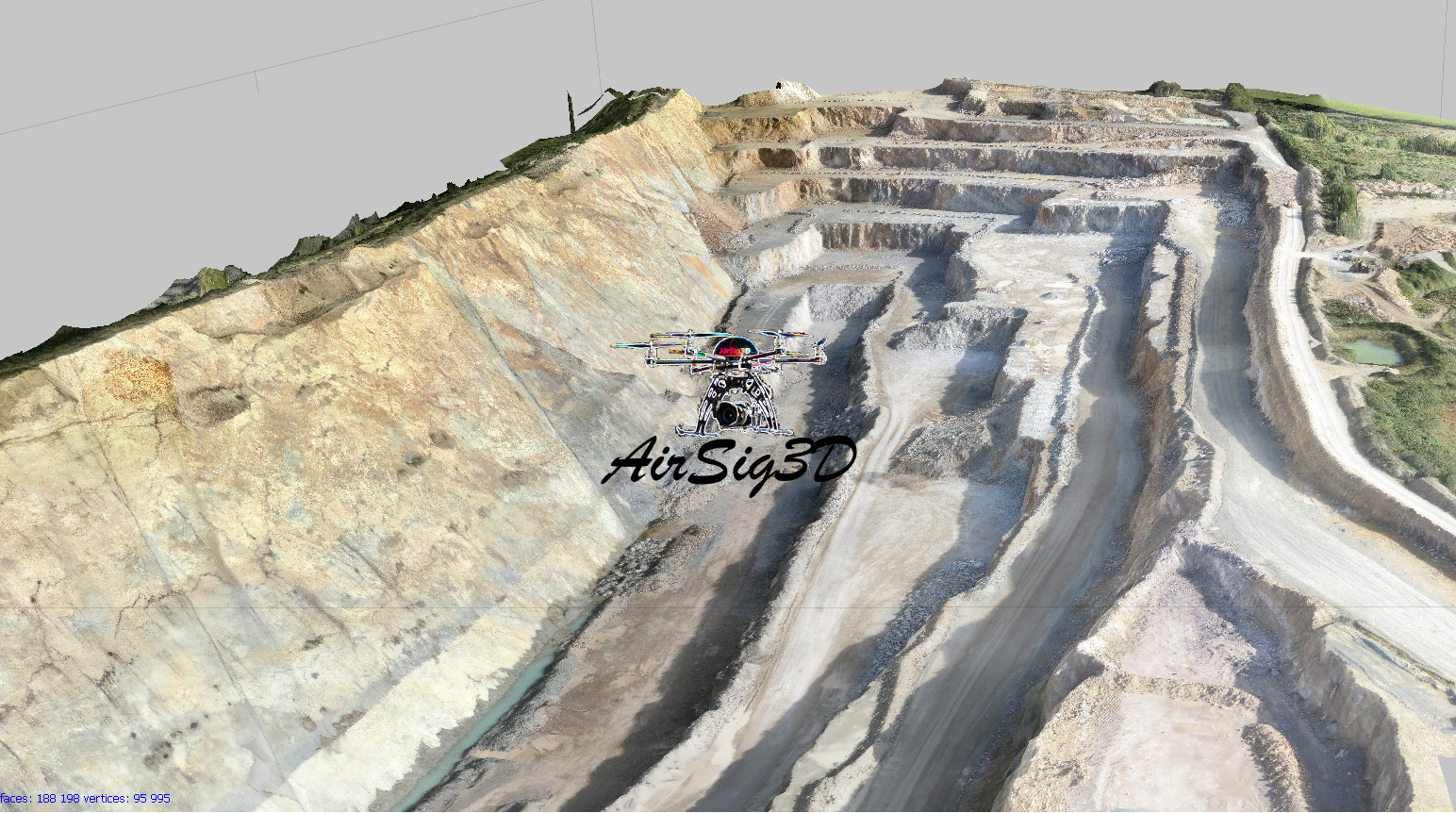
Mines and quarries
We're commited to offering the best 3D elevation models in a record time, using the latest technologies. From a simple survey to a more sophisticated drilling and blasting analysis including the global evolution of each site, possibilities are endless.
Take flight
3D HD images
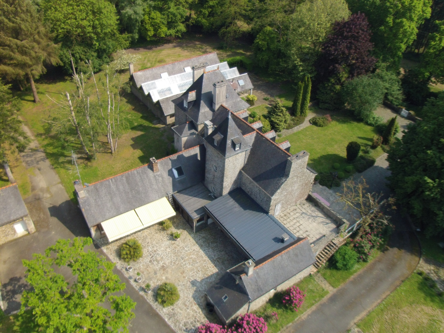
At AirSig3D, we believe that every event deserve its great picture or video, taken from one of our aircrafts. We also do aerial surveys of natural sites, private mansions... Do not hesitate to contact us for more informations.
Make your maps stand out
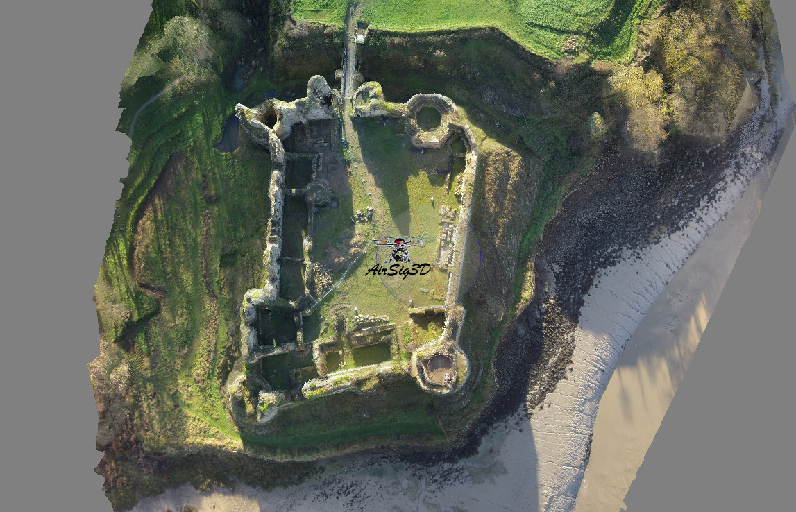
3D Mapping
Post processing allow us to build accurate, 3D maps from our images - and the digital elevation model that comes with it. AirSig3D's analysis is precise enough for it to be used in a wide variety of fields, from archeology to architecture to agriculture.
Since 2011, we at AirSig3D strive to provide the highest quality of 3D rendering and digital elevation models

Flexibility
Our own development of innovative ground control points survey modules, combined with our knowledge in geographic information systems (GIS Software) enables us to do high precision, reliable work in almost any kind of environment.

Expertise
This knowledge is backed up by actual field expertise, more so in drilling and blasting in mines and quarries. No wonder our founder is a senior mining engineer - and a private pilot - who has been roaming Africa's mining industry for nearly a decade!

Safety
Safety is something we take really seriously, and all our drones comply with the French law regarding the usage of unmanned aircrafts.